A growing number of maritime companies and navies are using autonomous underwater vehicles (AUVs) to map the ocean seabed for environmental, commercial and research purposes, Norwegian firm Kongsberg has said.
AUVs are increasingly deployed to monitor shipwrecks, marine ecosystems and chemical degradation – key use cases in the Oslo Fjord, which “looks like somebody has gone over the sea floor with a rake”, according to Kjetil Jensen, Kongsberg Discovery’s Vice-President of Seabed Mapping.
Several species of fish are disappearing from the fjord, while important areas of kelp forest and eelgrass have declined in recent years.
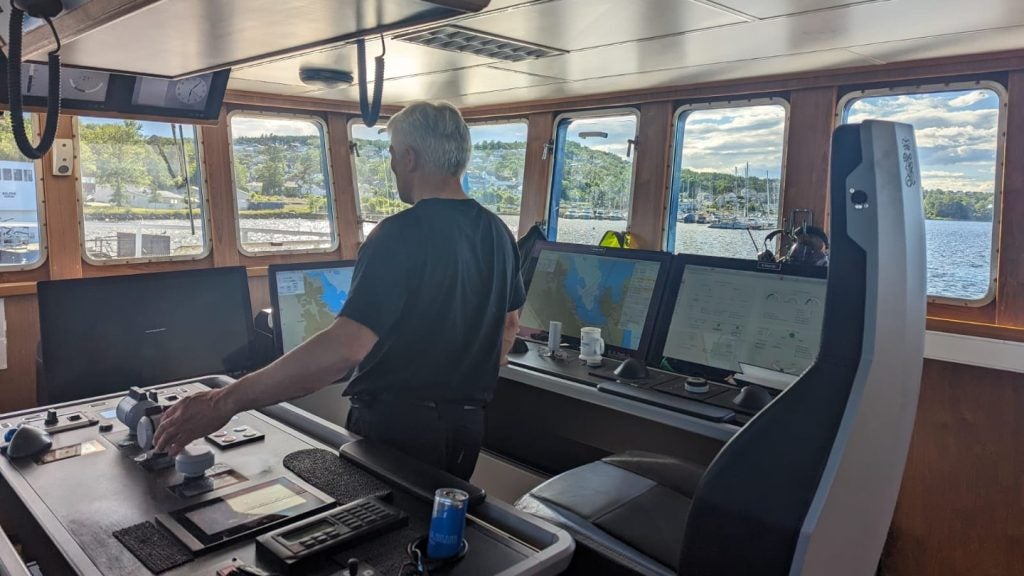
Jensen demonstrated Kongsberg’s HUGIN AUV acoustic sonar technology to reporters aboard the Simrad Echo on Monday (10 June), in Horten, Oslo. He claimed it is “probably the best equipped research vessel in the world”, pointing to its 50 sensors, measurement accuracy of 0.00001 degrees and seabed mapping capable of reaching the ocean's deepest point: 10,984 meters in the Mariana Trench.
Jensen also said the HUGIN is able to collect data of high enough resolution to "estimate biomass and perform species discrimination with such accuracy that the system can detect if its a herring or a mackerel".
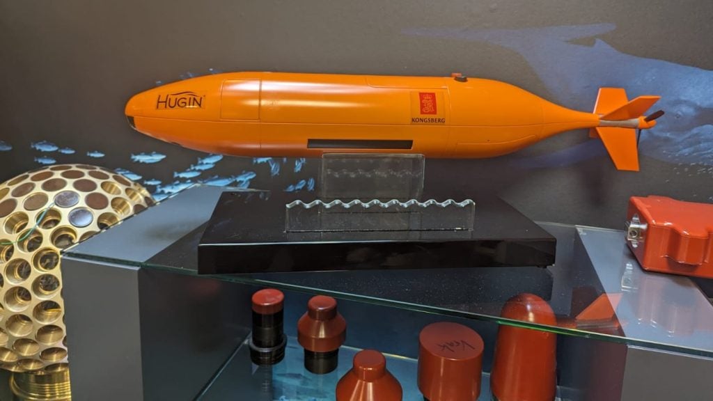
Most HUGIN models can spend up to 15 days at sea, travelling distances up to 2,200km and diving to depths of 6,000 metres. Each AUV carries a wide array of sensors, including synthetic aperture sonars, multi-beam echo sounders, cameras, lasers, sub-bottom profilers and environmental sensors.
While the HUGIN has predominantly piqued the interest of maritime companies, a Kongsberg official told Ship Technology that 12 naval forces also use it, with the US Navy currently negotiating a contract.
Kongsberg, a giant in the maritime, aerospace and offshore industries, is majority-owned by Norway’s government.
Environmental conservation or deep-sea mining damage?
Such AUV technology will bolster the prospects of Seabed 2030 – a global initiative to create a complete map of the ocean floor by 2030.
Created under the Deep Ocean Stewardship Initiative (DOSI), Seabed 2030 aims to map the seabed to advance understanding of deep-sea ecosystems and support sustainable management.
Amid rising sea levels, the ramifications are potentially seismic for communities in low-lying coastal communities.
Jensen, however, remained cautious about the project’s targets. “Only around 25% of the world’s seabed is mapped to a useful degree”, he told Ship Technology.
However, only 6% of the ocean floor was mapped to an adequate resolution when the initiative first started in 2017.
There is vast commercial potential for Kongsberg’s HUGIN in the field of deep-sea mining, where instantaneous seabed mapping is a useful asset.
While Jensen spoke guardedly about any involvement with deep-sea mining companies, he said Kongsberg Discovery would not rule out potential contracts.
At the start of this year, the Norwegian government greenlit a proposal in parliament to allow deep-sea mining companies to scour an area as large as Italy in Norwegian waters. The decision was criticised strongly amid reports that deep-sea mining could cause damage of up to $500bn.
More than 20 countries have called for a temporary suspension of deep-sea mining contracts, calling for more ecological studies to be carried out first.
Finland, Germany, Brazil, Canada, Chile, Portugal and Costa Rica are among the countries calling for a pause on the practice, while China, the UK, Mexico and Nauru joined Norway in support of fast-tracking licenses for deep-sea mining.
While the environmental benefits of seabed mapping technologies remain a cause for optimism, such innovative maritime research will do well to extricate itself from the significant damage deep-sea mining is poised to inflict on the ocean floor.